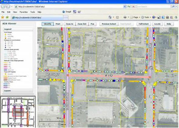
Browser-based GIS Viewer
Our clients have the option to view the collected data and analysis through a GIS viewer where all information is accessible from a dedicated web page.
- Just like Google maps, the GIS viewer allows panning across or zooming into a jurisdiction’s map.
- Turn on and off layers to identify barrier types for different pedestrian features.
- View collected data and analysis on a dedicated web page from any computer.
The ability to have documents updated regularly with real-time information on compliance facilitates barrier removal, and easy access from a website improves data input as projects are programmed and funding is secured, allowing regular measuring of progress.